
Mapping of the Moon exhibition celebrates 300 years of lunar cartography
The Map House has created an exhibition of lunar maps created in the 300 years leading up to the first moon landing, which took place 50 years ago today.
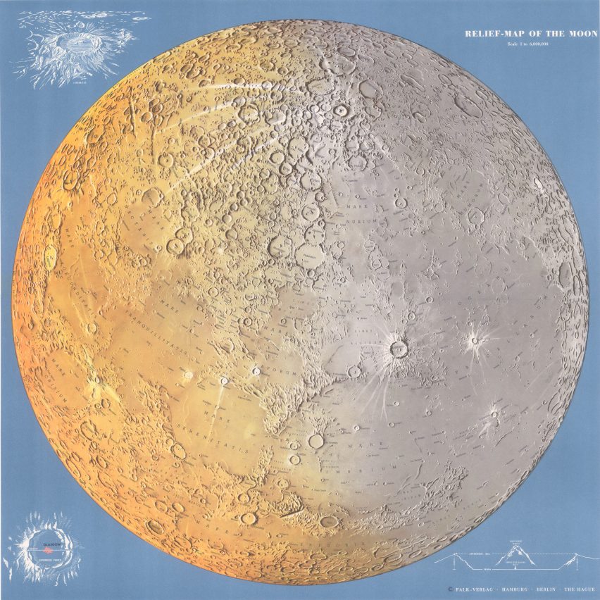
Mapping of the Moon:Â 1669-1969 contains around 80Â celestial maps from the 17th century, alongside 20 moon globes and scientific instruments.
The collection includes many maps from the space age including Hammond Inc's Moon Chart from 1966
London antique-map gallery and seller The Map House has put on the exhibition, which is open until 21 August, to celebrate the 5oth anniversary of the first moon landing in 1969.
The Map House put on the exhibition to demonstrate the scientific endeavour that took place over 300 years to allow the Apollo 11 moon landing mission to take place.
"In order to reach a destination, you generally need a map," Mary Beal, gallery manager at The Map House told Dezeen. "This also stands for anyone embarking on the adventure into space." The USAF Lunar Wall Mosaic was created by combining over one hundred pictures
Some of the most interesting maps in the collection were created in the 1960s as part of the effort to land a man on the moon.
"I think one of the most striking maps in the collection is the phenomenal USAF Lunar Wall Mosaic by the United States Air Force Aeronautical Chart and Informational Service (ACIC)", said Beal.
The Moon by Rand McNally Company was published in 1958
"The NGA (now the Defense Mapping Agency) reported that 281 of the best l...
| -------------------------------- |
| Teddy Schuyers? Guts redesigns ostomy bag for sex, sport and everyday life |
|
|

Villa M by Pierattelli Architetture Modernizes 1950s Florence Estate
31-10-2024 07:22 - (
Architecture )