
Surging Seas software shows potential impact of rising sea levels on US cities
An interactive mapping tool provides a scary glimpse of how cities such as New York, Boston and Miami might end up if sea levels continue to rise.
The Google Earth plugin, Surging Seas: Extreme Scenario 2100, allows users to pan around 3D imagery of America's coastal cities and see what they would look like if sea levels rose by eight feet (2.4 metres).
It was created by the Climate Central organisation to warn of the effects of climate change on some of the country's most densely populated places.
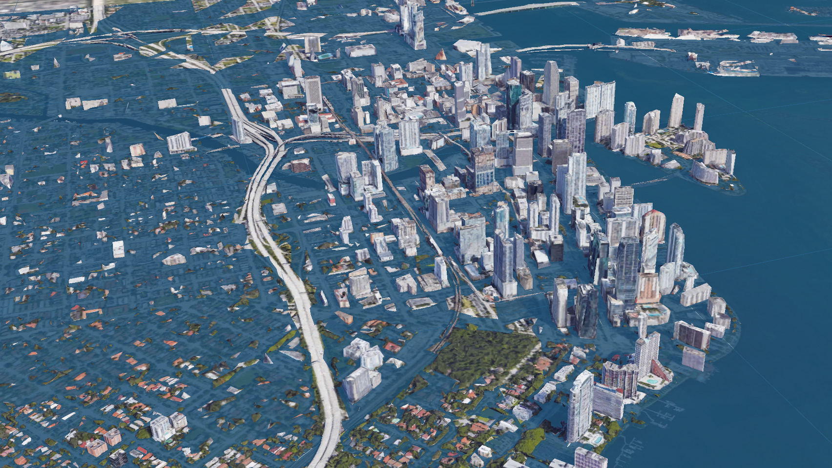
The Surging Seas: Extreme Scenario 2100 interactive maps show what cities like Miami would look like if sea levels rose eight feet (2.4 metres)
Once downloaded and installed, the software overlays Google Earth's 3D renderings of cities to show which areas would be affected. When applied to New York, almost all the streets in Lower Manhattan's Financial District appear under water, along with large portions of the West Side, Chelsea and the Lower East Side.
The majority of Long Island City, Flushing Meadows and the Rockaways in Queens are washed out, while Brooklyn's Greenpoint, Red Hook and Navy Yards take severe hits.
Landmarks like Ellis Island and LaGuardia Airport would also be completely submerged.
Large areas of Boston appear underwater in the visuals, which are overlaid onto Google Earth
The scenario looks even worse for Miami, which is entirely consumed by water in the visuals, with just the tops of buildings and elevated infrastructure visible above the blue wash.
Only t...
| -------------------------------- |
| DISEÃO DE UNA CASA DE 14 X 26 METROS. Esquema básico. |
|
|

Villa M by Pierattelli Architetture Modernizes 1950s Florence Estate
31-10-2024 07:22 - (
Architecture )